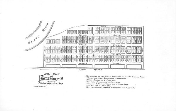
First plat map of Portsmouth 1803
- Title
- First plat map of Portsmouth 1803
- Description
- Henry Massie set up the boundaries and streets for Portsmouth in 1803. He named the town after Portsmouth, New Hampshire.
- Creator
- Henry Massie
- Date
- 1803
- Coverage
- Portsmouth, Scioto County, Ohio
- Rights
- Scioto County Public Library
Citation
Henry Massie, “First plat map of Portsmouth 1803,” Scioto County Public Library Local History Digital Collection, accessed January 21, 2026, https://www.sciotolibrary.org/history/items/show/2625.


